GeoZentra Service Limited
Precision. Innovation. Excellence in Surveying & GIS Solutions.

MORE ABOUT US
We Provide Exceptional Solutions for Clients
We deliver accurate, high-quality surveying services, leveraging modern drone and satellite mapping technology. From land measurements to geospatial analysis, our team ensures precision-driven results for your projects.
Our Story
Geozentra Service Limited was founded to provide accurate, technology-driven surveying and GIS solutions. We combine professional expertise with cutting-edge tools to deliver dependable results for clients across Nigeria.

More Service Us
We Are Leading Survey and GeoInformatic Company
Land Surveying
The are variations of passages of abe, but majority have suffered incididunt dolore magna aliqua

Petroleum and Gas
The are variations of passages of abe, but majority have suffered incididunt dolore magna aliqua
High Quality Work
We use advanced satellite imagery to map large areas with exceptional accuracy, ideal for urban planning, agriculture, and infrastructure projects.

Electric Engineering
The are variations of passages of abe, but majority have suffered incididunt dolore magna aliqua.

Topographic Surveys
We create detailed topographic maps to represent terrain features, essential for engineering design, construction, and environmental studies.

Cadastral Surveys
We specialize in cadastral mapping for land ownership documentation, ensuring your property rights are clearly defined and protected.
WHY CHOOSE US
Providing A Reliable Serivce To Industry Sector
Lorem ipsum dolor sit amet, consectetur adipiscing elit, sed do eiusmod tempor incididunt ut labore et dolore magna aliqua.

Reliable Services
Lorem ipsum dolor sit amet, consectetur adipiscing elit, sed do eiusmod tempor incididunt ut labore et dolore magna aliqua.

Industrial Business
Lorem ipsum dolor sit amet, consectetur adipiscing elit, sed do eiusmod tempor incididunt ut labore et dolore magna aliqua.
Our Team

John Doe

Jane Doe

We Focused On Build A Strong Industry

We Involved In Engineers Of Maintenance

Adewale O.
Finance Manager
"Geozentra delivered our site survey with exceptional accuracy and speed. Their professionalism is unmatched."

Chidinma K.
Finance Manager
"The drone mapping service helped us save time and costs. Highly recommended!"

Musa B.
Finance Manager
"Reliable, precise, and customer-focused. Geozentra is my go-to for all surveying needs."
CLIENT FEEDBACK
What areas do you serve?
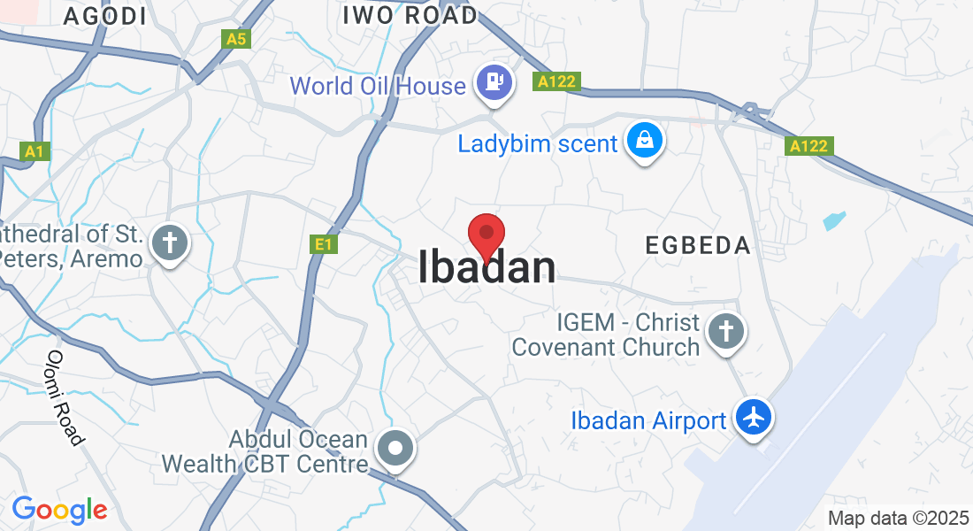
We provide surveying and GIS services across Nigeria, with our headquarters in Ibadan.

How accurate are your surveys?
Our surveys meet industry standards, using advanced GPS, drone, and satellite technologies for maximum accuracy.

Do you handle both small and large projects?
Yes, we cater to individuals, businesses, and government agencies, regardless of project size.

How quickly can you deliver results?
Project timelines vary based on size and complexity, but we always aim for timely delivery without compromising quality.

Can you provide mapping for agricultural purposes?
Absolutely. We offer drone and satellite mapping tailored for precision agriculture and land management.

How do I request a quote?
You can contact us via phone at +234 805 348 4304 or email [email protected] with your project details.

Get In Touch
Email: [email protected]
Address
Office: Ibadan Nigeria
Assistance Hours
Mon – Sat 9:00am – 8:00pm
Sunday – CLOSED
Phone Number:
+234 805 348 4304

